 http://upload.wikimedia.org/wikipedia/commons/thumb/7/78/USA_states_population_density_map.PNG/800pxhttp://upload.wikimedia.org/wikipedia/commons/thumb/7/78/USA_states_population_density_map.PNG/800px-USA_states_population_density_map.PNG
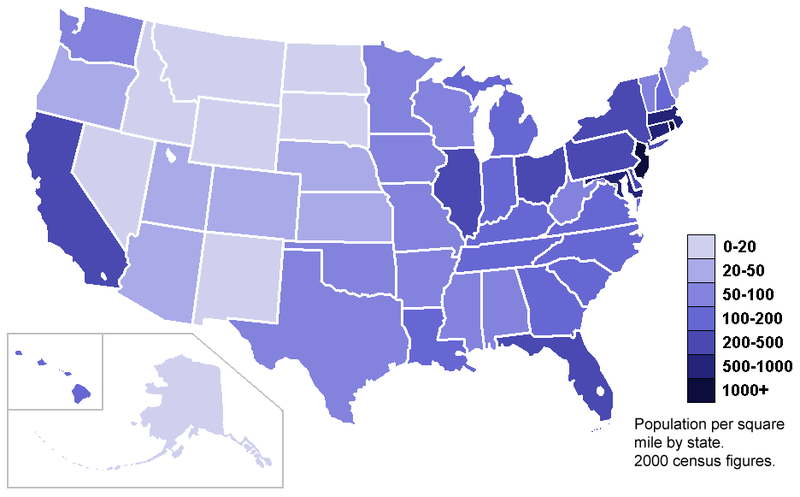
This maps are used to compare data distribution among different areas using certain standardized data such as ratios and rates. This is a Standartized map showing the 200 census population density according to the states area in square miles.
No comments:
Post a Comment