 https://courseware.e-education.psu.edu/courses/geog482/graphics/citationexample.jpg
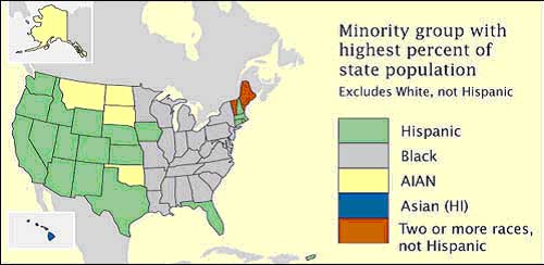
This are maps that are used to display nominal data. This is a nominal area choropleth that shows states in U.S with the highest percentage of minority group by use of different colors.
No comments:
Post a Comment